Home
Home
There is a story about Kerak that sounds invented, and isn't.
In 1183, a wedding was taking place inside the castle. Outside, Saladin's army was besieging it. The bride's mother sent dishes from the feast out to Saladin, who accepted them — and asked in return which tower the newlyweds occupied, so his siege engines could avoid it.
That is the kind of place Kerak is. A blunt, brutal military machine of a building, wrapped in stories too good to forget.
What Is Kerak Castle?
Kerak Castle is a large Crusader fortress in the town of Al-Karak in central Jordan, begun in the 1140s and among the largest the Crusaders built anywhere in the Levant.
It sits roughly 140 km south of Amman at about 900 metres above sea level, on a narrow spur with steep valleys falling away on three sides. The position was not chosen for the view.
- Construction begun: around 1142, under Pagan the Butler
- Crusader name: Crac des Moabites
- Key feature: extensive underground vaulted halls
- Fell to Saladin: 1189, after two failed sieges
- Later work: Mamluk additions under Baybars, 1263
The name appears as both Kerak and Karak in English; both are correct.
What makes it unusual among Crusader fortresses isn't decoration — there's almost none. It's the scale of the engineering, and how much survives underground where later destruction couldn't reach.
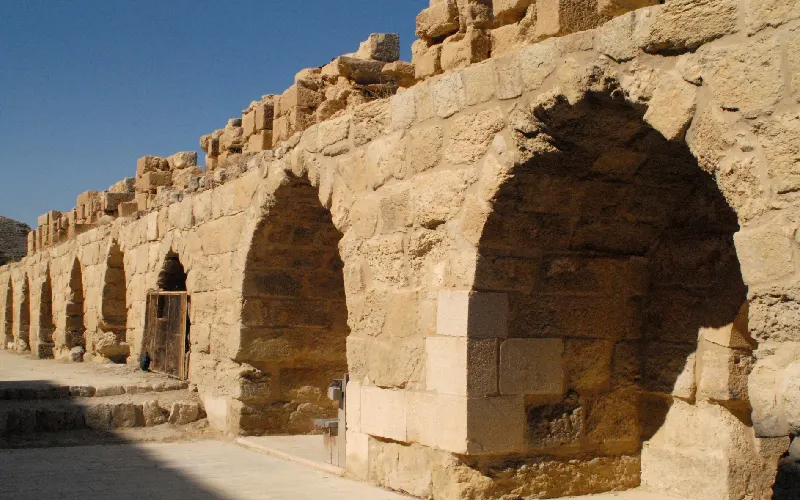
Why Kerak Was Built Where It Was
Kerak stands on the King's Highway, the route that has run north to south through the Jordanian plateau for three thousand years, linking Damascus to Aqaba, Arabia and the Red Sea. Whoever held Kerak controlled traffic between Egypt and Syria — the two halves of the Muslim world at the time.
That was the point. As the fortress of the Crusader lordship of Oultrejordain, Kerak let a small force interdict caravans, tax merchants and threaten the land route between Cairo and Damascus.
The geography did most of the defending:
- Three sides fall away into deep wadis, making assault impossible
- The fourth was cut off by a deep ditch carved into solid rock
- The elevation gave commanding sightlines in every direction
The hilltop had been fortified long before. It appears in biblical texts as Kir of Moab, capital of the Moabite kingdom, and was later Nabataean and Byzantine.
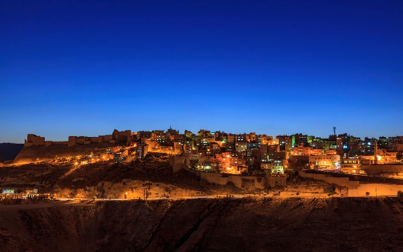
Because the Crusader states were long, thin and chronically short of manpower. They couldn't garrison a frontier, but they could hold strongpoints along the routes an enemy army had to use. Kerak, Shobak and Montreal worked as a system — each controlling a stretch of road, each forcing a besieging army to stop and commit time it usually didn't have. It worked for most of a century, until a single opponent unified Egypt and Syria and could afford to wait.
Raynald of Châtillon and the Sieges
Kerak's most notorious chapter belongs to one man.
Raynald of Châtillon acquired the castle in 1176 by marriage to Stephanie of Milly. He was exceptionally reckless even by the standards of a violent century, and his actions brought Saladin's army to the walls.
From Kerak he raided caravans on the King's Highway, including during formal truces. More provocatively, he launched a naval expedition into the Red Sea, apparently intending to threaten the holy cities of Arabia — a direct challenge to Saladin's standing as protector of the pilgrimage routes.
The first siege came in 1183, during the wedding described above. The defenders held, and Saladin withdrew when a relief force under the dying King Baldwin IV approached.
The second, in 1184, ended the same way.
The third succeeded, but only after everything changed. At Hattin in 1187, Saladin destroyed the field army of the Kingdom of Jerusalem and executed Raynald. With no relief possible, Kerak was besieged again and held out for months — accounts describe the garrison selling their own families for food — before surrendering in 1189.
The castle did exactly what it was built to do. It simply outlived the kingdom it defended.
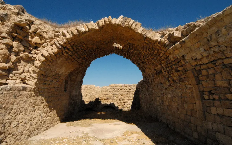
Three things together. The terrain removed three approaches entirely. The rock-cut ditch meant siege towers couldn't reach the walls without first filling it. And the underground cisterns and magazines let a garrison outlast seasons rather than weeks. Medieval sieges were decided by whether the besieger could stay longer than the besieged could eat. Kerak was built to win that argument, and did — twice.
Customize Your Dream Vacation!
Get in touch with our local experts for an unforgettable journey.
Plan Your Trip
Inside the Castle
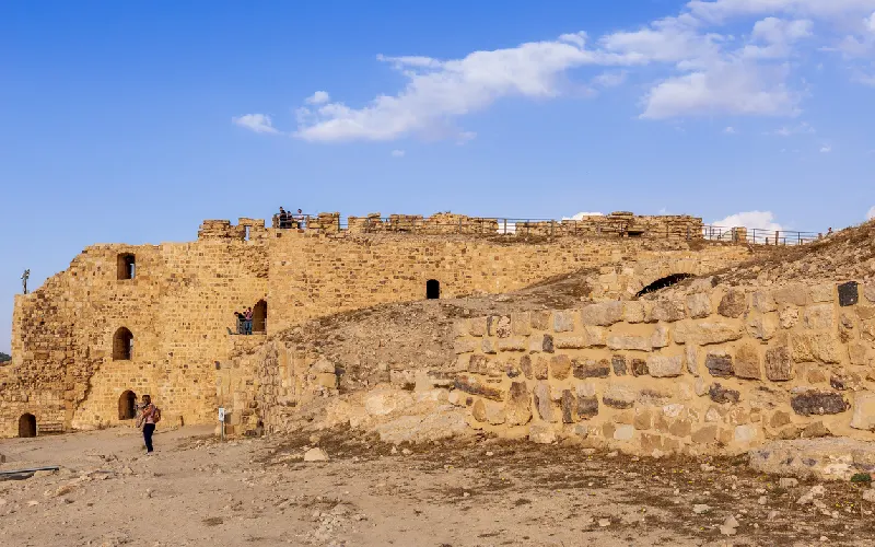
Kerak is more imposing than beautiful, and it knows it. Very little ornament. What there is instead is mass, space and darkness.
The upper court holds the Crusader structures — chapel remains and great halls, in roughly dressed limestone laid in regular courses. Functional, not decorative.
The lower court contains Mamluk work, including the palace complex. The difference in masonry is visible even to a non-specialist: smoother, more precisely fitted, occasionally decorated.
The underground galleries are what visitors remember. A vast network of vaulted halls, corridors and chambers runs beneath the castle — stables, barracks, storerooms and cisterns, a subterranean fortress out of reach of bombardment. The best-preserved parts of Kerak are down here, precisely because they were buried when everything above was knocked down.
The Mamluk tower on the northwest corner was added under Baybars in 1263.
The rock-cut ditch separating castle from town remains the most striking engineering on the site — a chasm carved by hand out of solid rock.
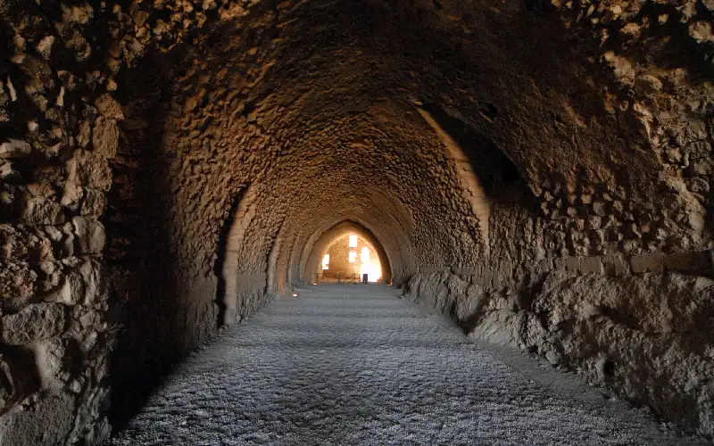
By continuing to be useful. Kerak was never simply abandoned — it passed from Crusader to Ayyubid to Mamluk to Ottoman hands, and each occupant repaired what they inherited. A castle that stays garrisoned stays maintained. The underground sections then survived the nineteenth-century demolitions, because below ground there was nothing worth destroying.
After the Crusaders: Decline and Demolition
Kerak's story runs another seven centuries after 1189.
Under the Mamluks it remained a major regional centre, serving at various points as treasury, prison and refuge. Its position on the crossroads between Arabia, Egypt and Greater Syria kept it relevant long after the Crusader states had vanished.
In 1840, Ibrahim Pasha of Egypt captured Kerak and deliberately destroyed much of the fortification — a punitive demolition to prevent its use against him. Most of what's missing from Kerak's walls today dates to this, not to any medieval siege.
In 1844, his garrison found itself besieged by a population it had never controlled, was starved out, and largely killed.
In 1893, the Ottomans re-established control with a resident governor and a garrison of around 1,400.
There was slower damage too. The stone contained saltpetre, used in gunpowder, and locals removed blocks to extract it. A fortress dismantled for its chemistry.
Kerak in the Landscape
Kerak makes far more sense placed in its region than treated as an isolated monument.
The King's Highway links a remarkable sequence running south from Amman: Madaba and its sixth-century mosaic map, Mount Nebo, Mukawir, then Kerak, then Shobak — another Crusader castle — and finally Petra. Every one exists because of the road.
To the west, the land falls more than 1,300 vertical metres towards the Dead Sea, visible from the walls on clear days along with the hills beyond. To the east lies the Moabite plateau, the grain highland that made the region worth holding in the first place.
Yes, and that changes how the site reads. Kerak was the principal fortress of Oultrejordain, working with Shobak some 80 km south and a scatter of smaller positions to control the King's Highway and the approaches to the Red Sea. The system extended across Syria, Lebanon and Palestine — including the far more famous Krak des Chevaliers. Kerak was its southern anchor, and the closest Crusader position to Arabia.
Construction began around 1142, making the Crusader fortress roughly 880 years old. The hilltop was fortified far earlier — it was the Moabite settlement of Kir of Moab, mentioned in biblical texts well over two and a half thousand years ago.
No, and the similar names cause constant confusion. Krak des Chevaliers is in Syria, was held by the Knights Hospitaller, and is generally considered the finest surviving Crusader castle anywhere. Kerak is in Jordan and was a secular lordship rather than a military-order castle. Both names derive from the same root meaning fortress.
Pagan the Butler, cupbearer to King Fulk of Jerusalem and lord of Oultrejordain, began construction in the 1140s. Later lords extended it, and the Mamluk sultan Baybars substantially rebuilt and enlarged it in 1263.
It comes from a Syriac and Aramaic root meaning "fortress" or "walled town." The Crusaders called it Crac des Moabites, referencing the biblical Moabite kingdom whose territory this had been.
It isn't, exactly — but the underground portions are best-preserved. The vaulted galleries were stables, storerooms, barracks and cisterns, protected from bombardment and able to sustain a garrison through a long siege. When the above-ground fortifications were demolished in 1840, the subterranean levels were left largely intact.
The story appears in medieval accounts of the 1183 siege and is widely repeated. Chroniclers record that the bride's mother sent dishes out to Saladin, and that he asked which tower the couple occupied so his engines could be directed elsewhere. Whether it happened exactly as told can't be verified, but it was recorded close enough to the events to reflect how Saladin's contemporaries understood his conduct.
No. It was besieged repeatedly and never stormed. It fell in 1189 by surrender after a prolonged blockade, once Hattin had destroyed any prospect of relief. Its capture by Ibrahim Pasha in 1840 came against a very different castle in a very different era.
Substantial but incomplete. Large sections of the outer fortifications were destroyed in 1840, and further stone was removed by locals extracting saltpetre. What survives includes the Crusader upper court, the Mamluk palace and tower, the rock-cut ditch and the extensive underground galleries. Jordanian antiquities authorities have carried out consolidation work, and part of the interior houses an archaeological museum.


Learn about Jordan attractions, ancient history, and local traditions. Find must-visit places and start planning your unforgettable experience today.
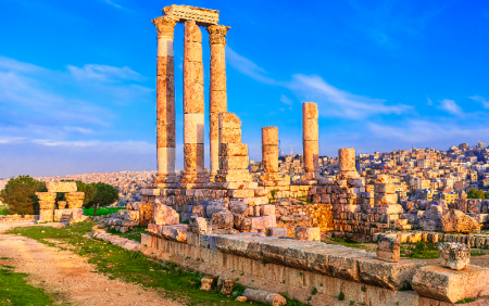
Jordan's capital and largest city, Amman spreads across a landscape of hills with a history reaching back nine millennia — from Neolithic settlement to Roman Philadelphia to modern Arab capital.
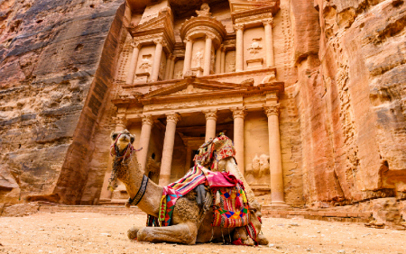
Petra is an ancient city carved into rose-red sandstone cliffs in southern Jordan, once the capital of the Nabataean civilisation and one of the most significant archaeological sites in the world — a UNESCO World Heritage Site and one of the New Seven Wonders of the World.
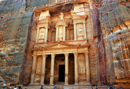
The Treasury (al-Khazneh) positioned opposite the main route into Petra. it was given by the local Bedouin tribes behind the belief that the urn on top of the front entrance contained the treasure of a pharaoh.
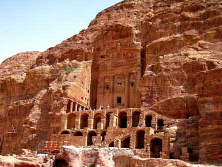
During any trip to Petra, you shouldn't miss the unpredictable Royal Tombs that took its name from the rich decoration. Know More!
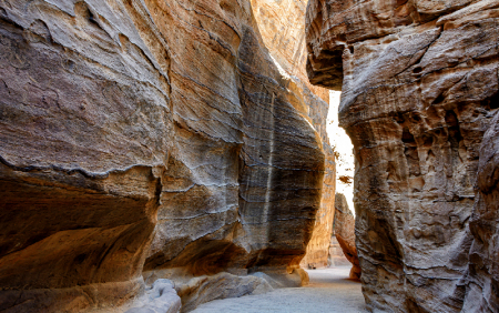
A 1.2-kilometre gorge with walls rising up to 180 metres, the Siq is Petra's main entrance — a natural rock fissure the Nabataeans turned into a processional way and a water system.
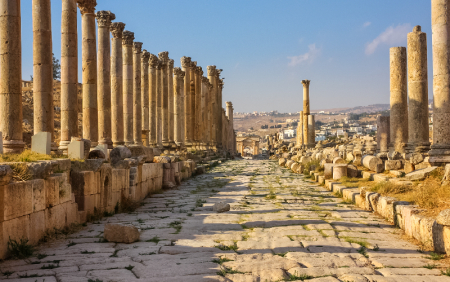
Jerash in northern Jordan is one of the best-preserved Roman cities outside Italy. A former member of the Decapolis league, it retains its colonnaded streets, temples, theatres and triumphal arches after nearly two thousand years.
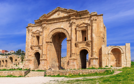
The monumental Roman gateway built to welcome Emperor Hadrian to ancient Gerasa in AD 129 — and still the most dramatic first sight in Jerash today.
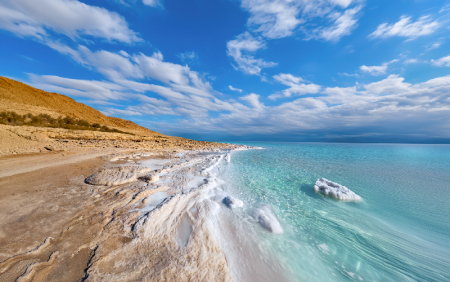
The Dead Sea is a hypersaline lake in the Jordan Rift Valley, sitting around 430 metres below sea level — the lowest point on Earth and one of the saltiest waters in the world. Its mineral-rich water and therapeutic mud have drawn health seekers for thousands of years.
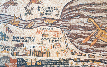
A sixth-century mosaic pavement in Madaba, Jordan, the Madaba Map is the oldest surviving cartographic image of the Holy Land — and the earliest detailed depiction of Jerusalem anywhere.
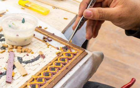
An ancient town on Jordan's King's Highway, Madaba holds the greatest concentration of Byzantine mosaics in the country — including the oldest surviving map of the Holy Land.
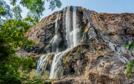
A chain of thermal waterfalls in a desert gorge below sea level, Ma'in Hot Springs has drawn bathers since antiquity — and appears on the sixth-century Madaba Map by name.
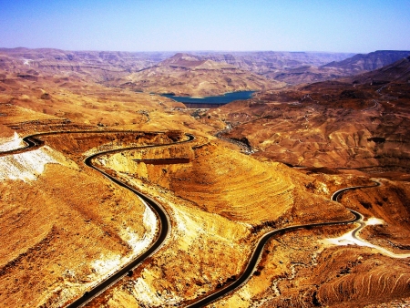
Mount Nebo is an elevated Mountain in Jordan, approximately 817 metres above sea level,.... Know More!
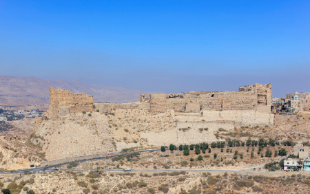
Built from the 1140s on a spur above the King's Highway, Kerak Castle is one of the largest Crusader fortresses in the Levant — and the setting for one of the strangest sieges in medieval history.
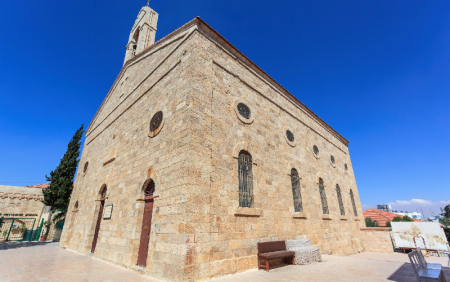
A working Greek Orthodox church in Madaba, Jordan, built in the 1890s over a Byzantine predecessor — and home to the sixth-century mosaic map of the Holy Land.

Mukawir (Machaerus) is an hour away and about 45 kms, away from Madaba on the Kings’ Highway. Know More !
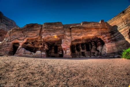
The Nabataeans (Nabateans) were an Arab people who lived in northern Arabia and the Southern Levant. They built the assumed capital city of Petra. Know more!
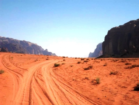
Lawrence of Arabia is a film directed by the global British director David Lean in 1962 and production of Sam Spiegel and starring Peter O'Toole role Lawrence.